Real Estate Research, Market Analytics and GIS
Using their expertise, training, and advanced technology, Alvarez & Marsal’s senior real estate experts provide applied research and thought leadership in a number of areas.
Real Estate Research:
- Explaining and predicting critical real estate capital market trends, risks, and opportunities in equity and debt markets
- Identification and analysis of significant real estate economics impacting commercial real estate demand, supply, cap rates, investor behavior, and values
- Development of applied commercial real estate investment strategies and portfolio risk analytics
- Statistical analysis and modeling, spatial analytics, and academic literature review and application related to property tax appeals, real property damages, portfolio disputes, and mortgage financing, and other disputes
- Real estate trends continuing professional education for law firms and banks
Market Analytics:
- Real estate cycle analysis and forecasting for 100+ U.S. markets covering office, retail, industrial, multifamily, and hospitality[1]
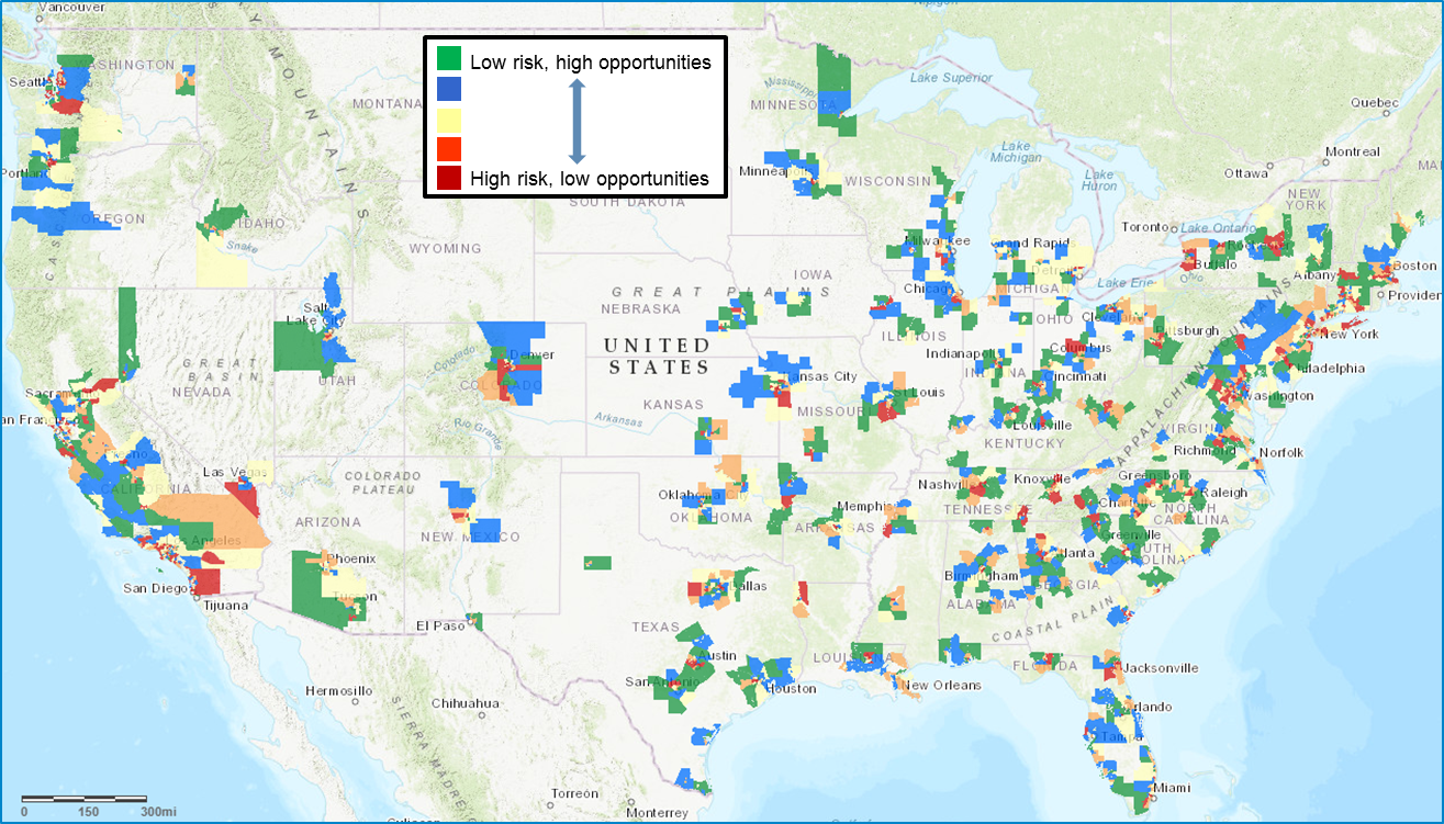
- Proprietary models and investment strategy products that identify “tomorrow’s risks and opportunities today” for 2,000+ U.S. submarkets covering office, retail, industrial, and multifamily sectors with applications for equity and debt markets[2]
Mapping and Geographic Information Systems (GIS):
We develop both static maps and interactive cloud-based GIS sites for use in analysis of property trends, demographic data, environmental conditions, and other market and business operations data. GIS are often utilized in relation to class action litigation and mass tort matters. Our professionals also advise on strategic business decision-making.
Our professionals provide:
- Maps which display the locations of residential property owners along with the location of actual or alleged contamination and overlays of property transaction data
- Map-based analyses across a wide range of industries, including healthcare, manufacturing, retail, real estate, energy, construction materials and utilities
- Analyses of a variety of mapping and GIS data, including detailed population trends, population demographics, housing statistics, traffic counts and highways, and business competitor data
- Animated maps for use in deposition or live testimony to convey trends in property data, migration of contaminants, or other critical variables
- Integrated graphs, photographs and maps to maximize our client’s understanding of the forces at work in the market
- Interactive web-based maps to facilitate access by multiple users
- Fully customized GIS solutions delivered through a secure web site
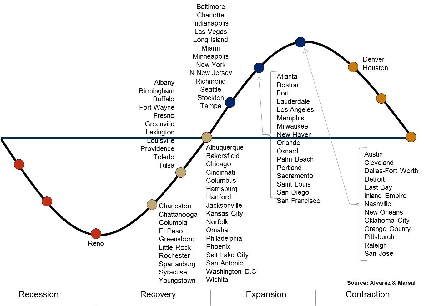
[1] See Exhibit 2 Example U.S. real estate cycle positions
[2] See Exhibit 1 Example U.S. submarket risk and opportunity forecasts